×

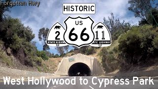
Forgotten Hwy's video: Historic US 66 East US 99 S CA 11 N - Figueroa St Colorado Blvd - Cypress Park to Pasadena CA

@Historic US 66 East, US 99 S, CA 11 N - Figueroa St, Colorado Blvd - Cypress Park to Pasadena, CA
After exiting off the Arroyo Seco Parkway back onto Figueroa St, we continue our trek eastern by first heading north. By doing this, we stay on LRN 165. (LRN 165 included the portion of the Arroyo Seco up to the LA River, then transitioned back to Figueroa while the northern segment of the Parkway became LRN 205). We continue as Former CA 11 and Historic US 66, 66 ALT, & 6 East, 99 South. US 6 and 99 leave us shortly there after, using Ave 26 to reach San Fernando Rd. We wind through Cypress and Highland Parks to reach Colorado Blvd (LRN 161) in Eagle Rock. There we join an old alignment of US 99 South and head across the Colorado Blvd Bridge into Pasadena. Before we do, CA 11 leaves us for Linda Vista Ave to continue on LRN 165. We then head into Downtown Pasadena where we meet US 66 (from the south) and 99's (from the north) original routings at Fair Oaks Ave and continue onto old LRN 9/Colorado Blvd (later transferred to LRN 161) and turn left onto Altadena Dr to follow the original alignment of US 66, 99 and LRN 9. US 66 is the road that needs no introduction. In 1926, as the first US Highways were being laid out across the country, a route was to be established running from Los Angeles, CA to Chicago, IL. This rather trivial route was given the number of Route 60 until proprietors in the southern part of the country raised issue with it's route numbering. Highways divisible by 5 were to be major routes, either border to border or ocean to ocean. This first incarnation of US 60 did not meet these qualifications and these people were able to successfully argue for the change in numbering. This led to the birth of US 66, which was chosen for the route as it was deemed 'catchy' and easy to remember. US 66 would later go on to become the most traveled highway during the dust bowl, leading those in the midwest to travel the road seeking the promised prosperity in California, as in the Grapes of Wrath. It was that book that lent the name 'The Mother Road' to the highway, a term that has stuck to this day and become synonymous with the highway. Towards the end of the Dust Bowl era and the Great Depression, California wanted to reinvent 66's image to being a 'Vacation Route', that is a route that leads to a vacation spot. Up until 1936, US 66 had entered Los Angeles on Broadway, arbitrarily ending at 7th St. When the change was approved by AASHTO, California moved US 66's western terminus from Los Angeles to Santa Monica. This replaced historic Signed State Route 2 from Olympic Blvd to Myra Ave, then used the remainder of Santa Monica Blvd to reach US 101 at Sunset Blvd. From there, US 66 turned left onto Figueroa, following it to Eagle Rock, ultimately heading across Colorado Blvd and re-joining it's original alignment at Fair Oaks Ave in historic Pasadena. As newer superhighways were being built, Route 66 originally made use of them. The first limited access highway in the western United States - The Arroyo Seco Parkway - replaced most of Figueroa and led 66 straight into Pasadena. Plans were in place to build multiple of these superhighways - modern day freeways - in southern California. Some, like the original Santa Monica Freeway replacing Santa Monica Blvd and to be signed as part of US 66, never came to be. Those newfangled freeways turned out to be the death of the US highways however. In 1956, the Interstate System was adopted by the federal government, leading to states becoming flush with cash to build new freeways. Three new Interstate Highways that were proposed in California threatened Route 66 itself: I-10, I-15, and I-40, all major, principal, routes. This, in addition to the Great Renumbering of 1964 in California, led to the removal of US 66. In 1964, US 66 was truncated back to Pasadena having been replaced by SR 11 and SR 2. From then on, Route 66 only remained until it's replacements were completed. It's old routings were even officially numbered by the state as it's successors (i.e: US 66 through Amboy was signed as US 66 but was Route 40 according to Caltrans). The only exception was for the portion from SR 30 in La Verne to I-15 (modern I-215) in San Bernardino. This remained Route 66, and is still legally part of SR 66 to this day (minus cities who have requested relinquishments). US 66 had been pushed back all the way to Needles in 1972. The only reason it was still in Needles was because I-40's bypass of the city had not been completed yet. In 1977, US 66 from Chicago to Scotland, MO - just outside Joplin - was removed after I-55 and I-44 had been completed. This was followed in 1979 with another western truncation from Needles, CA to Sanders, AZ at the Jct of US 666, before the ultimate deletion of US 66 in 1985. Thanks for watching! Follow and Support Me: Website: forgottenhwy.com Twitter: http://bit.ly/hwytweet Instagram: http://bit.ly/hwyinsta Facebook: http://bit.ly/hwyfacebook Patreon: http://bit.ly/hwypatreon

8

3
Forgotten Hwy
Subscribers
1.2K
Total Post
139
Total Views
97.5K
Avg. Views
1.6K
View Profile
This video was published on 2020-05-04 22:30:13 GMT by @Forgotten-Hwy on Youtube. Forgotten Hwy has total 1.2K subscribers on Youtube and has a total of 139 video.This video has received 8 Likes which are lower than the average likes that Forgotten Hwy gets . @Forgotten-Hwy receives an average views of 1.6K per video on Youtube.This video has received 3 comments which are lower than the average comments that Forgotten Hwy gets . Overall the views for this video was lower than the average for the profile.

Other post by @Forgotten Hwy